Omniscape Impact: a new tool for assessing the effects of habitat restoration on ecological connectivity
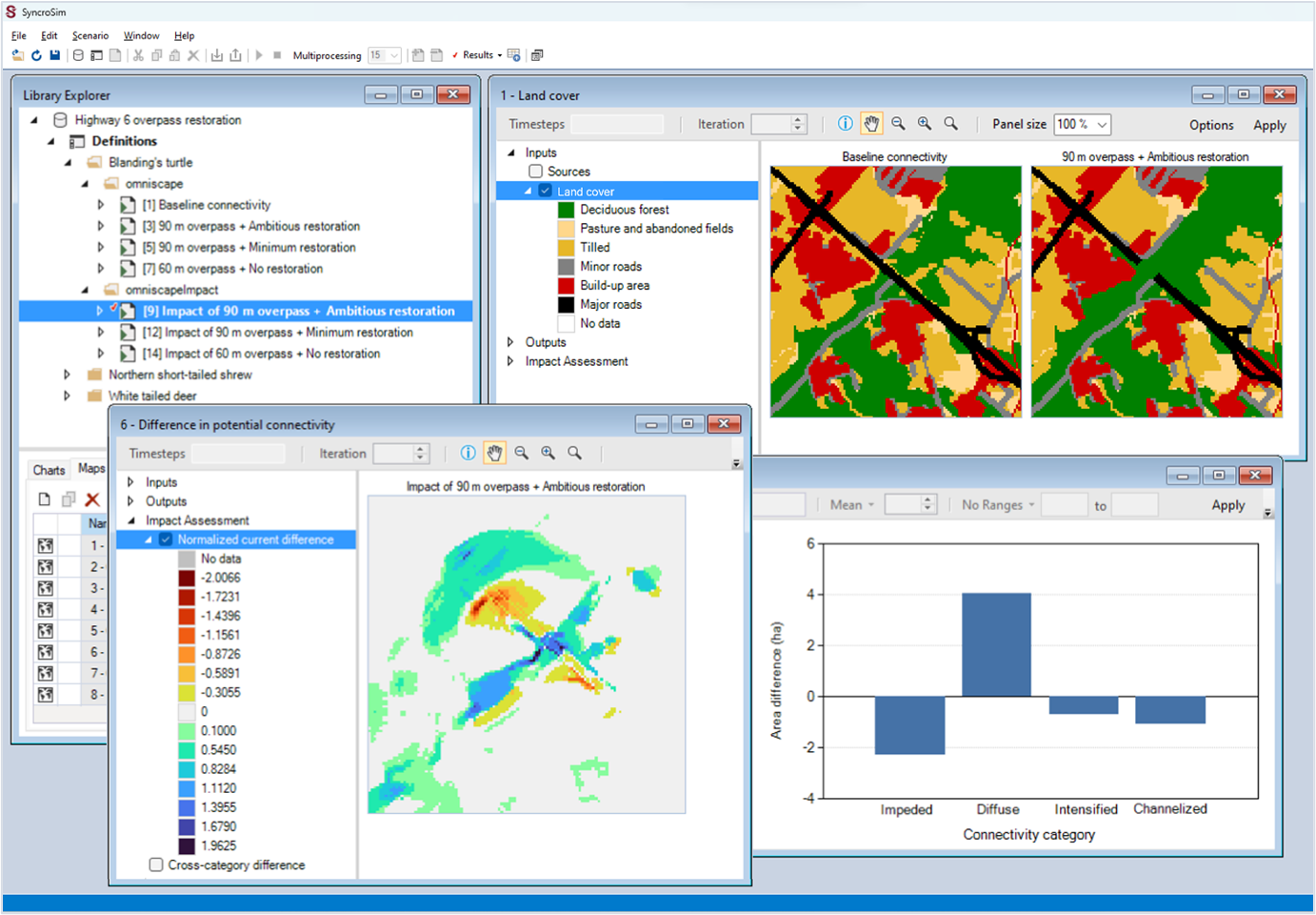
ApexRMS has developed a new tool to assess the impact of alternative habitat restoration options on future ecological connectivity. The Omniscape Impact tool combines a map of land cover with information about how species move through the landscape to produce a habitat connectivity map, representing potential movement flow across a landscape. Once connectivity maps are produced under alternative landscape conditions, such as pre- and post-restoration land cover, results are compared to produce spatial and tabular assessments of the impact of the proposed restoration on ecological connectivity.
Funding for the Omniscape Impact tool was provided by Parks Canada through the National Program for Ecological Corridors to support connectivity restoration efforts in the Cootes to Escarpment EcoPark System Ecological Corridors Pilot Project.
The tool is built on a commonly used model for connectivity analysis, called Omniscape, and is implemented as an extension of the open-source omniscape package in SyncroSim. For instructions on how to get started and step-by-step tutorials, visit the package’s updated documentation page.