We forecast the fate of ecosystem services, including carbon, animal habitat, habitat connectivity, and recreation.
We forecast the fate of ecosystem services, including carbon, animal habitat, habitat connectivity, and recreation.
Carbon Sequestration
ApexRMS forecasts the effects of land use and land cover (LULC) change on ecosystem carbon. Working principally with the U.S. Geological Survey’s LandCarbon project, we have developed a unique suite of software tools that project the effects of LULC change on carbon dynamics across varying geographic scales. The Land Use and Carbon Scenario Simulator (LUCAS), for example, is a public-domain tool used by the U.S. Geological Survey to assess the carbon implications of LULC change across all land cover types in the U.S., including forests, wetlands, shrublands, and grasslands.
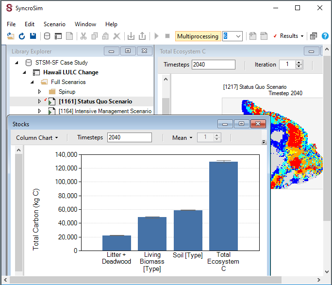
Total carbon projections across different stocks for a given scenario modeled using the SyncroSim package, LUCAS.
Selected Clients:



Wildlife Habitat
We use ST-Sim, an open-source package within the SyncroSim modeling framework, to project changes in wildlife habitat. ST-Sim allows users to develop stochastic, spatially-explicit models of landscape change for any vegetation community (Daniel, Frid, Sleeter, and Fortin, 2016). This output can then be used to generate corresponding spatial projections for habitat of various species, including estimates of uncertainty. For example, ApexRMS has used this approach to explore questions regarding the effects of timber harvest, wildfire, and climate change on woodland caribou habitat in the boreal forest (Daniel, 2017) and migratory bird habitat in north eastern British Columbia (Norris, Frid, Debyser, De Groot et al., 2021).
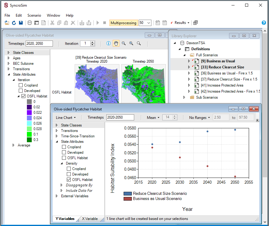
Projected estimates of habitat suitability across management scenarios modeled by the SyncroSim package, ST-Sim.
Selected Clients:





Habitat Connectivity
We use a variety of methods for identifying key habitat patches and corridors vital to maintaining habitat connectivity across multiple scales for different species (Rayfield, Pelletier, Dumitru, Cardille et al., 2016). By coupling these methods with our open-source ST-Connect package for SyncroSim, we forecast how a landscape’s habitat connectivity may be affected by varying land management and climate change scenarios. For example ApexRMS has applied this approach locally to prioritize future conservation efforts in Southern Ontario, and around the city of Montreal, Canada (Albert, Rayfield, Dumitru, and Gonzalez, 2017).
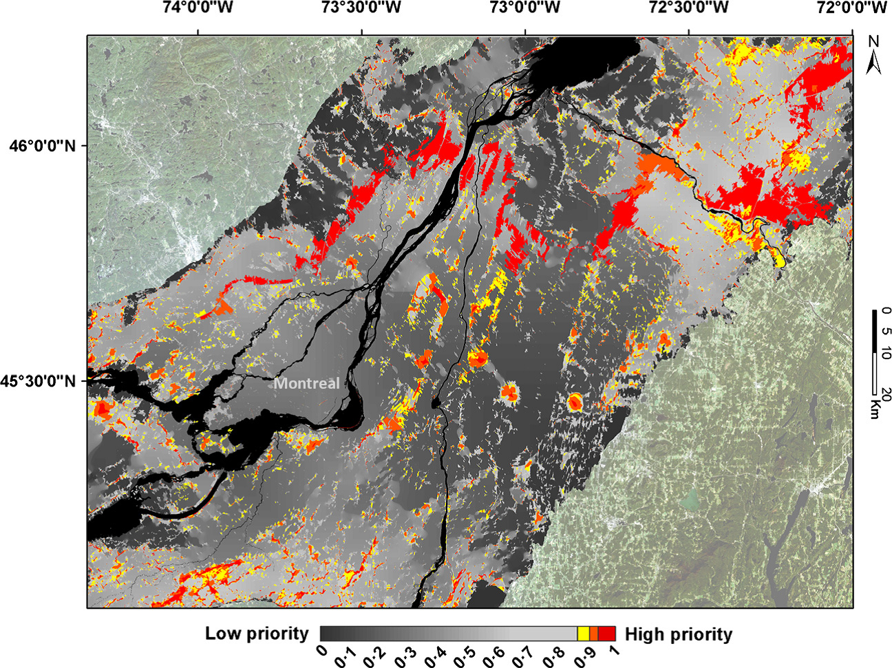
Patches of species' suitable habitat ranked on a scale of low to high priority for future habitat connectivity modeled using the SyncroSim package, ST-Connect.
Selected Clients:



People and Nature
We analyze and visualize the ways that people access parks. Parks provide a suite of ecosystem services including opportunities for people to socialize, exercise, and interact with nature. We have developed methods that allow land managers to quantify human activity in parks to better allocate resources and improve park design for people and wildlife. Using anonymized data from smart devices, we can provide information on when, where, and how people use parks (Filazzola et al., 2022). ApexRMS has applied these methods to support biodiversity monitoring in Montreal parks, understand park use for Conservation Halton, and provide insights into the social inequalities of park access for Toronto.
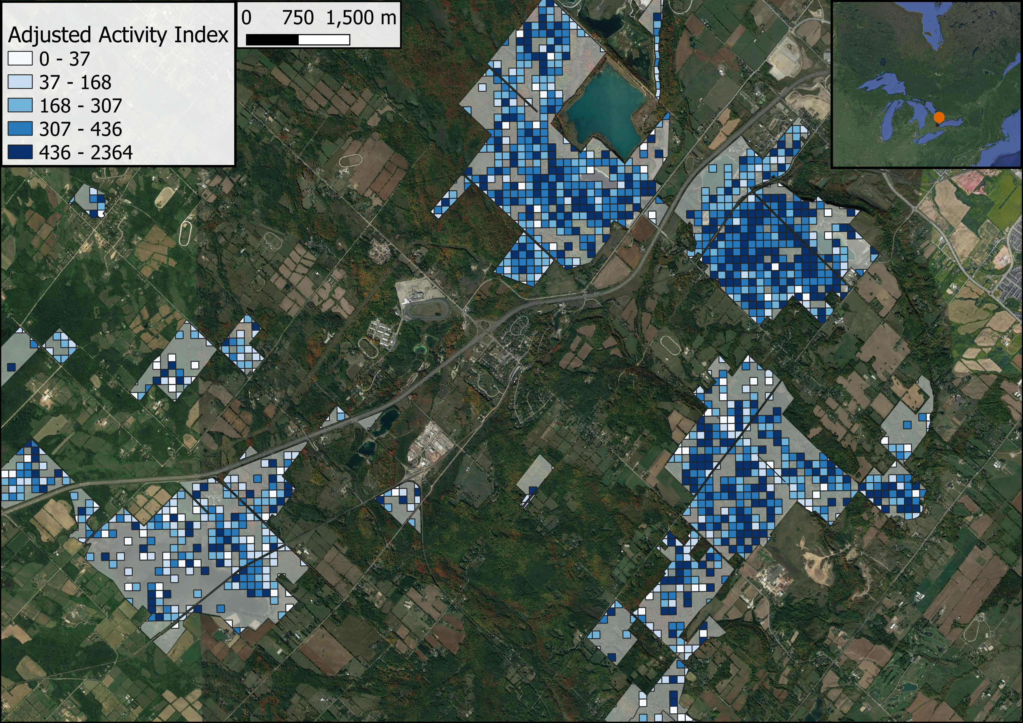
Average monthly patterns of human activity derived from anonymized smart device data for Conservation Areas managed by Halton Conservation, Ontario, Canada.
Selected Clients:


Carbon Sequestration
ApexRMS forecasts the effects of land use and land cover (LULC) change on ecosystem carbon. Working principally with the U.S. Geological Survey’s LandCarbon project, we have developed a unique suite of software tools that project the effects of LULC change on carbon dynamics across varying geographic scales. The Land Use and Carbon Scenario Simulator (LUCAS), for example, is a public-domain tool used by the U.S. Geological Survey to assess the carbon implications of LULC change across all land cover types in the U.S., including forests, wetlands, shrublands, and grasslands.

Total carbon projections across different stocks for a given scenario modeled using the SyncroSim package, LUCAS.
Selected Clients:

Selected Clients:

Wildlife Habitat
We use ST-Sim, an open-source package within the SyncroSim modeling framework, to project changes in wildlife habitat. ST-Sim allows users to develop stochastic, spatially-explicit models of landscape change for any vegetation community (Daniel, Frid, Sleeter, and Fortin, 2016). This output can then be used to generate corresponding spatial projections for habitat of various species, including estimates of uncertainty. For example, ApexRMS has used this approach to explore questions regarding the effects of timber harvest, wildfire, and climate change on woodland caribou habitat in the boreal forest (Daniel, 2017) and migratory bird habitat in north eastern British Columbia (Norris, Frid, Debyser, De Groot et al., 2021).

Projected estimates of habitat suitability across management scenarios modeled by the SyncroSim package, ST-Sim.
Selected Clients:
Selected Clients:

Habitat Connectivity
We use a variety of methods for identifying key habitat patches and corridors vital to maintaining habitat connectivity across multiple scales for different species (Rayfield, Pelletier, Dumitru, Cardille et al., 2016). By coupling these methods with our open-source ST-Connect package for SyncroSim, we forecast how a landscape’s habitat connectivity may be affected by varying land management and climate change scenarios. For example ApexRMS has applied this approach locally to prioritize future conservation efforts in Southern Ontario, and around the city of Montreal, Canada (Albert, Rayfield, Dumitru, and Gonzalez, 2017).

Patches of species' suitable habitat ranked on a scale of low to high priority for future habitat connectivity modeled using the SyncroSim package, ST-Connect.
Selected Clients:

Selected Clients:

People and Nature
We analyze and visualize the ways that people access parks. Parks provide a suite of ecosystem services including opportunities for people to socialize, exercise, and interact with nature. We have developed methods that allow land managers to quantify human activity in parks to better allocate resources and improve park design for people and wildlife. Using anonymized data from smart devices, we can provide information on when, where, and how people use parks (Filazzola et al., 2022). ApexRMS has applied these methods to support biodiversity monitoring in Montreal parks, understand park use for Conservation Halton, and provide insights into the social inequalities of park access for Toronto.

Average monthly patterns of human activity derived from anonymized smart device data for Conservation Areas managed by Halton Conservation, Ontario, Canada.
Selected Clients:

Selected Clients:

